
In a significant expansion of its orbital capabilities, Vantor has announced the introduction of two next-generation electro-optical imaging satellite classes, Pulse and Vantage, designed to bridge the gap between high-frequency monitoring and ultra-high-resolution intelligence. The Colorado-based commercial satellite operator and spatial intelligence provider unveiled the strategic roadmap on Thursday, detailing a dual-tiered approach that promises to deliver a level of clarity and temporal frequency previously unavailable from a single commercial provider. By integrating these two distinct satellite architectures into a unified operating environment, Vantor aims to streamline the "tip-and-cue" process, allowing customers to detect changes in near real-time and immediately investigate them with unprecedented detail.
The announcement marks a pivotal shift for Vantor as it enters the competitive small satellite market while simultaneously pushing the boundaries of what is technically achievable in commercial imaging resolution. The Pulse constellation, consisting of more than 10 small satellites, is engineered for high-revisit frequency, while the larger Vantage satellites are designed to capture the world’s most detailed commercial imagery. This hybrid constellation strategy reflects a growing demand in the geospatial intelligence (GEOINT) sector for more agile, responsive, and precise data streams to support national security, disaster response, and global supply chain monitoring.
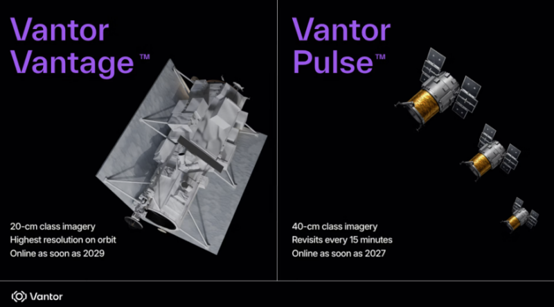
The Pulse Constellation: Achieving 15-Minute Revisit Rates
Vantor’s entry into the small satellite sector is headlined by the Pulse class. This fleet will comprise at least ten 40-centimeter-class resolution satellites. While many existing small-sat constellations prioritize frequency over image quality, Pulse is designed to maintain a high standard of resolution that allows for the identification of specific vehicle types and infrastructure changes. The defining feature of the Pulse constellation is its revisit rate; Vantor anticipates that the fleet will be capable of imaging the same location on Earth every 15 minutes.
This cadence is a significant leap forward from current industry standards, where revisit rates for high-resolution imagery often range from several hours to once per day. A 15-minute window transforms satellite imagery from a series of "snapshots" into a near-continuous monitoring tool. For defense and intelligence agencies, this means the ability to track the movement of convoys or the progress of port activities in near real-time. For environmental and humanitarian organizations, it offers a way to monitor rapidly evolving situations such as wildfire spread or flood progression with life-saving accuracy.
The first satellites in the Pulse fleet are scheduled to become operational in 2027. By leveraging a smaller satellite bus, Vantor can deploy these units more cost-effectively and replace them more frequently, ensuring that the latest sensor technology is always in orbit. This approach also provides a level of resilience; a large constellation of smaller satellites is less vulnerable to single-point failures compared to a small number of massive, expensive spacecraft.
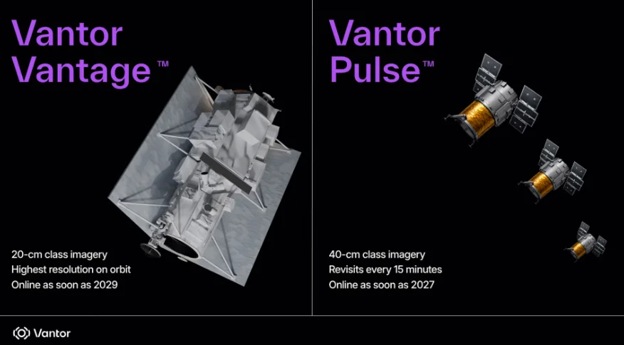
The Vantage Class: Setting a New Benchmark for Resolution
While Pulse provides the frequency, the Vantage class provides the "exquisite" detail required for high-stakes decision-making. Based on a larger, more traditional satellite bus, Vantage will feature 20-centimeter-class resolution. According to Vantor, this will represent the highest commercial resolution available on orbit, surpassing current industry leaders that typically max out at 30-centimeter resolution.
The jump from 30-centimeter to 20-centimeter resolution is more than a marginal improvement; it represents a 125% increase in the number of pixels for a given area. This level of clarity allows analysts to see smaller objects, such as individual equipment components, markings on aircraft, or subtle changes in terrain that could indicate underground construction or landmines. Vantor CEO Dan Smoot emphasized that this clarity is essential for missions where misidentification carries high risks.
The deployment of Vantage is slated to begin as early as 2029, with the first two satellites leading the way. These spacecraft will build upon the legacy of Vantor’s current WorldView constellation, which includes the high-performance Legion satellites. By pushing the resolution envelope to 20 centimeters, Vantor is positioning itself to compete directly with government-owned reconnaissance satellites, offering "sovereign-level" intelligence to commercial and international government clients who lack their own indigenous space assets.
Integration via Tensorglobe: The Power of Tip-and-Cue
The true innovation of the Pulse and Vantage announcement lies in the integration of these two capabilities. Historically, the GEOINT market has been fragmented. A customer might use one provider for wide-area, high-frequency monitoring (often at lower resolution) to detect an anomaly—a process known as "tipping." Once an anomaly is detected, they would have to contract a second provider with high-resolution satellites to "cue" a detailed image of that specific site. This process is often slowed by administrative hurdles, data compatibility issues, and the orbital mechanics of two different satellite fleets.
Vantor’s solution is to house both capabilities within its Tensorglobe geospatial intelligence platform. Under this model, the Pulse satellites act as the "tipping" mechanism, scanning large areas every 15 minutes. When the system’s AI or a human analyst identifies a point of interest, the Vantage satellites are cued to capture a 20-centimeter resolution image during their next pass.
"It’s the first time governments and businesses will be able to get image quality and speed under a single commercial system," Smoot stated. By eliminating the need to coordinate between multiple providers, Vantor claims it can speed up mission success at an exponential rate. Tensorglobe will also ingest data from the existing WorldView and Legion constellations, creating a multi-layered data environment that provides historical context alongside real-time updates.
Lessons from Global Conflict: The Driving Force for Innovation
The development of Pulse and Vantage has been heavily influenced by recent geopolitical events, specifically the ongoing war in Ukraine and U.S. operations in the Middle East. These conflicts have demonstrated that high-resolution geospatial intelligence is no longer just a "nice-to-have" for elite militaries; it is a fundamental requirement for modern landscape navigation, target identification, and battle damage assessment.
In Ukraine, commercial satellite imagery has played a high-profile role in documenting troop movements, verifying humanitarian corridors, and providing evidence of war crimes. However, these operations have also highlighted the limitations of current constellations. Cloud cover, nighttime, and infrequent revisit windows can create "blind spots" that adversaries can exploit. While Pulse and Vantage are electro-optical (and thus still subject to weather constraints), the high frequency of Pulse increases the statistical likelihood of capturing a clear image through "cloud gaps."
Smoot noted that where "exquisite capabilities" have been deployed, there has been a high rate of success. However, he cautioned that frequency without clarity is insufficient. The ability to see that "something" has moved is only half the battle; the ability to see exactly "what" has moved—and to do so within minutes of the event—is what enables successful mission outcomes.
Chronology and Future Roadmap
Vantor’s path toward this integrated constellation follows a clear timeline of technological evolution:
- Current State: Vantor operates the WorldView constellation, including the new Legion spacecraft. These assets provide 30-centimeter-class resolution and can revisit areas up to 15 times per day.
- 2027 (Pulse Launch): The first Pulse satellites are expected to reach orbit. This will mark the beginning of the 15-minute revisit capability and Vantor’s formal entry into the small-sat market.
- 2028: Expansion of the Pulse fleet to its full complement of 10+ satellites, enabling global high-frequency coverage.
- 2029 (Vantage Launch): The first two Vantage satellites are scheduled for deployment, introducing 20-centimeter resolution to the commercial market.
- 2030 and Beyond: Full integration of Pulse, Vantage, and WorldView data into the Tensorglobe platform, offering a tiered subscription model for sovereign and commercial entities.
Market Implications and Industry Reaction
The introduction of Pulse and Vantage is expected to trigger a response from other major players in the Earth observation industry, such as BlackSky, Planet, and Airbus. To date, the market has been somewhat divided between "high-revisit/low-res" and "low-revisit/high-res" providers. Vantor’s move to dominate both ends of the spectrum poses a significant competitive challenge.
Industry analysts suggest that Vantor’s strategy is aimed at capturing "sovereign" contracts—agreements where a nation-state pays for dedicated access to a portion of a satellite constellation. For many middle-power nations, building and launching a 20-centimeter resolution satellite is cost-prohibitive. By offering these capabilities through a commercial "operating system" like Tensorglobe, Vantor provides these nations with the intelligence of a superpower without the multi-billion-dollar price tag of a national space program.
Furthermore, the business sector is likely to find value in the 15-minute revisit rate. Industries such as insurance, commodities trading, and maritime logistics rely on timely data to assess risk and manage global assets. The ability to monitor a port or a disaster zone every 15 minutes could fundamentally change how these sectors respond to volatility.
Technical Challenges and Environmental Considerations
The ambitious goals set by Vantor are not without technical hurdles. Operating a constellation with a 15-minute revisit rate requires a sophisticated ground station network to downink massive amounts of data continuously. Furthermore, processing 20-centimeter resolution imagery requires significant computational power, especially when integrated with AI for automated feature extraction.
Vantor’s reliance on the Tensorglobe platform suggests a heavy investment in cloud computing and edge processing to handle these data loads. Additionally, the company must navigate the increasingly crowded Low Earth Orbit (LEO) environment. With thousands of new satellites planned for launch over the next decade, space situational awareness and debris mitigation will be critical to the long-term viability of the Pulse and Vantage fleets.
As Vantor moves toward its 2027 and 2029 milestones, the aerospace community will be watching closely to see if the company can deliver on its promise of "image quality and speed under a single commercial system." If successful, Vantor may not only redefine its own business model but also set a new global standard for how spatial intelligence is gathered, processed, and utilized in an increasingly complex world.
