
The global Earth observation industry is currently undergoing a fundamental paradigm shift, moving away from a period of localized experimentation toward a new era of large-scale operational utility. For decades, the primary output of satellite remote sensing was the "image"—a visual representation of the Earth’s surface used for human interpretation. However, the rapid integration of Artificial Intelligence (AI) and Machine Learning (ML) has transformed the requirements of the sector. Today, the demand has shifted from visual imagery to stable, repeatable, and automated measurements. As AI models are tasked with monitoring the planet in real-time, the industry is confronting a significant hurdle: the inherent inconsistency of satellite data and the "geospatial tax" that prevents many organizations from scaling their operations beyond the pilot phase.
The Historical Context of Earth Observation and the AI Influx
To understand the current challenges, it is necessary to examine the trajectory of Earth observation (EO) over the last fifty years. The field was pioneered by government agencies, most notably through the U.S. Geological Survey (USGS) and NASA’s Landsat program, which launched its first satellite in 1972. This was followed by the European Space Agency’s (ESA) Copernicus program and its Sentinel constellations, which democratized access to high-quality, medium-resolution data.
For much of this history, the volume of data was manageable for human analysts. Experts would select specific scenes, manually correct for atmospheric haze, and perform localized studies. The "NewSpace" revolution of the 2010s changed this dynamic by introducing hundreds of commercial small satellites into Low Earth Orbit (LEO). This explosion in data volume made manual analysis impossible, necessitating the rise of AI.
Initially, AI applications in EO were experimental. Researchers used curated datasets—clean, cloud-free images with clear labels—to train models for object detection, such as identifying ships at sea or counting swimming pools in a suburb. While these experiments proved that AI could "see" features in satellite imagery, they did not address the complexities of continuous, global-scale monitoring. As the industry moves into 2025 and 2026, the focus has shifted to operationalizing these models, where they must function across different seasons, geographies, and sensor types without human intervention.
The Structural Breakdown of the Data Model at Scale
The transition from "pilot" to "production" is where many EO-driven AI initiatives fail. In a controlled setting, an AI model might achieve 95% accuracy in detecting deforestation in a specific region of the Amazon during the dry season. However, when that same model is deployed across the entire continent throughout the year, performance often degrades.
This degradation is caused by variability. Earth observation data is shaped by a multitude of shifting factors:
- Sensor Drift: No two satellite sensors are identical. Even satellites in the same constellation can have slight variations in spectral sensitivity, leading to inconsistent readings over time.
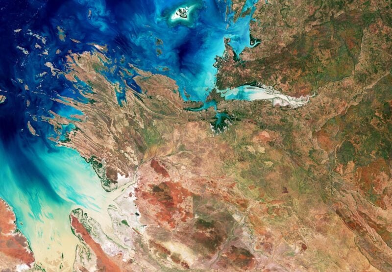
- Atmospheric Interference: The atmosphere is a dynamic filter. Clouds, aerosols, water vapor, and smoke change the way light reflects off the Earth and reaches the sensor. Without rigorous atmospheric correction, an AI might mistake a change in air quality for a change in ground cover.
- Temporal and Geometric Inconsistency: Revisit patterns vary, and the angle at which a satellite views a target (the "look angle") changes. This creates geometric distortions and shadows that can confuse AI models trained on "straight-down" (nadir) imagery.
When these inconsistencies are not addressed at the source, they create what industry experts call a "geospatial tax." This refers to the immense amount of time and capital—often estimated to be 80% of a project’s budget—spent on cleaning, orthorectifying, and normalizing data before it can be used for actual analysis.
The Push for Standardization: FAIR-EO and CEOS ARD
Recognizing that data fragmentation is the primary bottleneck to industry growth, several international initiatives have emerged to standardize how Earth observation data is prepared and delivered. One of the most significant is the FAIR-EO project, an initiative under the Horizon Europe OSCARS project. FAIR-EO advocates for data that is Findable, Accessible, Interoperable, and Reusable. The goal is to ensure that EO resources are "AI-ready" out of the box, allowing developers to integrate data into advanced workflows without manual preprocessing.
Complementing this is the Committee on Earth Observation Satellites (CEOS) and its Analysis Ready Data (ARD) framework. CEOS ARD defines a set of minimum requirements for satellite data products. For a dataset to be considered "Analysis Ready," it must be processed to a level where a user can perform time-series analysis or multi-sensor integration with minimal additional effort. This includes rigorous radiometric calibration and atmospheric correction.
The importance of these standards cannot be overstated. According to Eric von Eckartsberg, Chief Revenue Officer at EarthDaily, the difference between "imagery" and "measurement" is the foundation of operational AI. While imagery is for looking, measurements are for computing. For AI to provide reliable risk assessments or long-horizon environmental tracking, the underlying data must be as stable as a laboratory measurement.
Characteristics of AI-Ready Data
For Earth observation data to support continuous, automated monitoring at scale, it must possess three core characteristics:
1. Scientific Calibration and Consistency
Data must be radiometrically calibrated so that a pixel value representing a specific reflectance on Monday is identical to the same reflectance on Friday, regardless of atmospheric changes. This allows AI models to detect subtle changes in vegetation health, soil moisture, or carbon sequestration without being misled by "noise" in the data.
2. High Temporal Frequency
Operational AI thrives on frequency. To monitor supply chains, agricultural yields, or wildfire risks, data cannot be a series of snapshots taken weeks apart. It must be a continuous stream. High-revisit constellations allow AI models to "learn" the normal patterns of a location, making anomalies much easier to detect.

3. Interoperability Across Constellations
In an ideal operational environment, an AI model should be able to ingest data from Landsat, Sentinel, and commercial providers like EarthDaily or Maxar interchangeably. This requires cross-calibration between sensors. If the data is interoperable, the "gaps" caused by cloud cover or sensor maintenance in one constellation can be filled by another, ensuring a seamless data flow.
Chronology of the Shift Toward Operational EO
The timeline of this evolution shows an accelerating move toward data maturity:
- 2014-2016: The launch of the Sentinel-1 and Sentinel-2 missions provides the first high-frequency, free, and open-access data, sparking a wave of AI experimentation.
- 2017-2019: The rise of SpatioTemporal Asset Catalogs (STAC) provides a standardized way to describe geospatial metadata, making it easier for machines to "find" data.
- 2020-2022: The COVID-19 pandemic highlights the need for remote monitoring of global supply chains, pushing EO from a niche scientific tool to a mainstream business intelligence asset.
- 2023-2025: Large Language Models (LLMs) and Geospatial Foundation Models (GFMs) begin to emerge. These models require massive, consistent datasets to "pre-train" on the Earth’s features, further increasing the demand for ARD.
- 2026 and Beyond: The focus moves to "Digital Twins" of the Earth, where AI-ready data feeds into live simulations of the planet’s systems for climate adaptation and urban planning.
Broader Economic and Environmental Implications
The implications of solving the data consistency problem extend far beyond the space industry. In the financial sector, accurate Earth observation is becoming a cornerstone of Environmental, Social, and Governance (ESG) reporting. Organizations are now legally required in many jurisdictions to report on their carbon footprint and their impact on biodiversity. AI models fed with consistent, verifiable satellite data provide a transparent way to audit these claims.
In agriculture, the shift to operational AI-ready data enables "precision farming" at a global scale. By monitoring crop health and soil moisture daily, AI can help optimize fertilizer use and water consumption, which is critical for food security in a changing climate. According to market research, the global AI in agriculture market is expected to grow at a CAGR of over 20% through 2030, heavily reliant on the availability of stable EO data.
Furthermore, disaster response is being revolutionized. During the 2025 wildfire seasons, operational AI systems began using real-time, calibrated thermal data to predict fire spread patterns with higher accuracy than ever before. These systems do not have the luxury of "manual cleaning" time; they require data that is ready for ingestion the moment it is downlinked.
Conclusion: The Path Forward
The Earth observation industry is at a crossroads. The "imagery as a product" model, which served the industry for half a century, is no longer sufficient for the needs of modern Artificial Intelligence. As AI moves from the laboratory to the front lines of climate change, global trade, and security, the "geospatial tax" must be eliminated.
The advantage in the coming decade will belong to those who build Earth observation systems with automation and stability as their primary goals. By prioritizing scientific calibration, interoperability, and the standards set by initiatives like CEOS ARD, the industry can finally bridge the gap between "pretty pictures" and the actionable insights required to manage a planet in transition. When the data holds up, the models carry forward, and the promise of continuous global monitoring becomes a reality.
