

The digital age has irrevocably transformed the landscape of road travel, with applications such as Google Maps and Waze becoming ubiquitous, offering real-time routing, multi-destination planning, and offline map capabilities that have rendered traditional paper maps largely obsolete. These commercial navigation giants have undeniably made journeys more convenient and efficient, providing millions of drivers with instant access to dynamic traffic information and optimized routes. However, for those traversing Spain’s intricate network of national roads, motorways, and secondary routes, a powerful, albeit less flashy, alternative remains an absolutely indispensable tool: the official traffic map provided by the Dirección General de Tráfico (DGT). While commercial apps excel in user experience and predictive algorithms, the DGT map offers an authoritative, continuously updated, and comprehensive overview of road conditions, directly sourced from the governmental body responsible for traffic management and safety in Spain, making it a critical resource for pre-trip planning and real-time awareness that no responsible driver should overlook.
The evolution of road information dissemination has seen a dramatic shift over the past few decades. Before the advent of satellite navigation and internet-connected devices, drivers relied primarily on radio broadcasts, televised traffic reports, and static road signs for updates on congestion, accidents, or adverse weather. This information was often localized, delayed, and lacked the specificity that modern technology now provides. The transition to digital platforms began with rudimentary GPS devices, which, while offering turn-by-turn navigation, lacked real-time traffic updates. The subsequent rise of smartphone applications, powered by vast datasets and crowdsourced information, revolutionized the driving experience, transforming it from a potentially unpredictable endeavor into a highly managed and optimized journey. These commercial solutions, with their sophisticated algorithms and user-friendly interfaces, have set a high bar for convenience and efficiency, integrating everything from speed trap warnings to fuel station locations.
However, the DGT map occupies a unique and vital niche within this ecosystem. Unlike its commercial counterparts, which primarily focus on optimizing travel time or providing points of interest, the DGT’s platform is singularly dedicated to providing official, verified, and safety-critical information. Its mandate is not commercial; it is public safety and efficient traffic flow management. This fundamental difference underpins the quality and reliability of the data it presents. The DGT map is not merely another navigation tool; it is a direct channel to the most accurate, real-time insights into the operational status of Spain’s road network, making it an essential layer of information for anyone planning or undertaking a road trip within the national territory.
Unparalleled Real-Time Data and Official Verification
A cornerstone of the DGT map’s utility is its unparalleled commitment to continuous updates. The platform is designed to refresh its data around the clock, 24 hours a day, 7 days a week, ensuring that any significant incident or change in road conditions is reflected almost immediately. This constant vigilance is made possible by a robust operational framework involving multiple agencies. The primary contributors to this real-time data flow are the Agrupación de Tráfico de la Guardia Civil (Traffic Group of the Civil Guard) and the various Centros de Gestión de Tráfico (Traffic Management Centers) operated by the DGT across Spain. These entities are on the ground, directly observing, reporting, and managing incidents as they occur.
The Guardia Civil’s Traffic Group, with its extensive network of patrols and monitoring systems, serves as the eyes and ears of the DGT on the nation’s roads. Their officers are often the first responders to accidents, breakdowns, or other disruptions, and they are equipped to relay precise information about the nature, location, and severity of these events directly to the DGT’s central systems. Simultaneously, the Traffic Management Centers, strategically located throughout the country, employ a sophisticated array of technologies, including thousands of roadside cameras, induction loops embedded in the pavement, and other sensors, to monitor traffic flow, identify congestion, and detect unusual patterns. These centers also manage dynamic message signs on motorways, which are directly informed by the data they collect and process. This integrated approach ensures that the information displayed on the DGT map is not only current but also corroborated by multiple official sources, lending it an unmatched level of credibility and accuracy.
Comprehensive Incident Coverage and User Interface
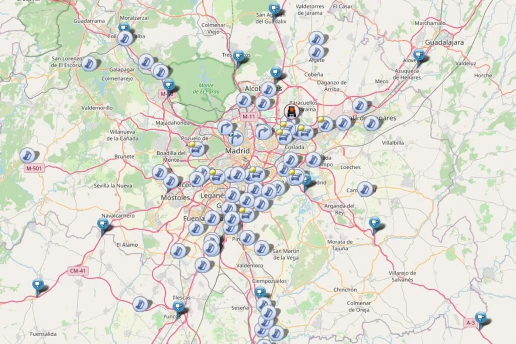
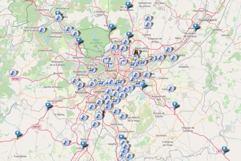
Upon accessing the DGT’s web-based platform, users are presented with a comprehensive map of Spain, overlaid with a series of intuitively designed icons. Each icon represents a specific type of incident or condition affecting the road network. The clarity and consistency of these symbols mean that most drivers can quickly grasp the nature of the alert. For instance, a red cross might indicate an accident, while a yellow triangle could signify roadworks or a specific restriction. Should there be any ambiguity, clicking on an icon reveals a detailed textual description, providing precise information about the event. This user-friendly approach ensures that critical data is accessible even to those who may not be familiar with every symbol.
The map’s utility extends far beyond merely indicating the presence of an incident. For accidents, which are unfortunately a frequent occurrence on any busy road network, the DGT map provides granular detail. Users can ascertain the exact kilometer point where an accident has taken place, the specific direction of traffic affected (e.g., northbound, southbound), and crucially, the precise time the information was added to the system. This level of detail is invaluable for drivers needing to make informed decisions about whether to proceed, seek an alternative route, or anticipate delays. Knowing that an accident occurred just minutes ago gives a very different perspective than an incident reported hours earlier, which might already be cleared. This real-time precision allows for proactive decision-making, significantly enhancing safety and reducing stress for travelers.

Beyond accidents, the DGT map is a repository of diverse and critical road information. It meticulously tracks and displays:
- Roadworks and Maintenance: These icons highlight areas where construction, resurfacing, or routine maintenance is underway. Details often include the expected duration of the works, specific lane closures, and any temporary speed restrictions, allowing drivers to factor these potential delays into their journey planning.
- Traffic Restrictions: Special restrictions, such as those for the transport of hazardous materials, oversized loads, or specific vehicle types during certain hours or on particular routes, are clearly marked. This is especially vital for commercial transport companies that must adhere to stringent regulations.
- Congestion and Retentions: While commercial apps excel at routing around traffic, the DGT map provides the official "state of play" for major traffic jams, often explaining the underlying cause if known (e.g., high volume, specific event). This information can be crucial for understanding broader traffic patterns beyond an individual’s immediate route.
- Environmental and Weather-Related Warnings: The map frequently highlights areas affected by adverse weather conditions. This includes snow and ice warnings, indicating roads where snow chains might be mandatory or where transit is restricted. It also alerts drivers to areas of reduced visibility due to heavy fog, torrential rain, or smoke from wildfires – a particularly relevant feature in a country prone to summer blazes. These warnings are critical for driver safety, prompting adjustments in driving style or even route changes.
- Planned Events: Major public events like marathons, cycling races, or large-scale demonstrations that temporarily affect road access are also indicated, providing foresight for local residents and visitors alike.
The interactive nature of the DGT map is further enhanced by its filtering capabilities. From a dedicated panel, typically located at the bottom of the interface, users can select precisely which categories of information they wish to view. This customization allows drivers to declutter the map and focus only on the alerts most relevant to their specific journey – perhaps only accidents and roadworks for a long-distance trip, or congestion for a daily commute. Furthermore, the search functionality, usually positioned at the top of the interface, allows users to quickly zoom to a specific province or town, making it exceptionally easy to scout conditions in a particular region without having to manually pan and zoom across the entire country.
Challenges and the Path Forward for Mobile Accessibility
While the DGT map offers an invaluable service, it is important to acknowledge certain limitations, particularly concerning its mobile accessibility. A recurring point of feedback from users is that the web interface is not perfectly optimized for mobile devices. When accessed via a smartphone, the map can sometimes be challenging to navigate; icons may appear too small, and the accompanying text alerts can be difficult to read without extensive zooming and panning. This suboptimal mobile experience can detract from the overall utility, especially for drivers attempting to quickly check conditions while on the go or during a brief stop. The recommendation to view the map in horizontal mode on a mobile device is a workaround but highlights the need for a more responsive and mobile-first design approach. This challenge might stem from the platform’s initial design philosophy, which likely prioritized desktop access for comprehensive operational oversight, or from resource allocation decisions in development. Addressing this would significantly enhance the map’s practical usability for the vast majority of modern drivers who rely heavily on their smartphones.
Synergy with Commercial Navigation and Broader Impact
Despite these interface nuances, the DGT map stands as a critical complementary tool to commercial navigation applications. While Google Maps and Waze excel in providing turn-by-turn directions, estimating arrival times based on current traffic, and suggesting alternative routes almost instantly, they do not always carry the same official weight or granularity of incident reporting as the DGT’s direct feed. Commercial apps often rely on aggregated data from multiple sources, including crowdsourcing, which, while effective for general traffic flow, might not always capture the precise details or official verification of severe incidents like major road closures due to accidents or extreme weather.

The synergy between these tools is where the true power lies for the informed traveler. A driver might use Google Maps for initial route planning and voice navigation, but a quick check of the DGT map before departure, and perhaps periodically during longer journeys, provides an essential layer of official verification and detailed incident awareness. For instance, if the DGT map shows a significant road closure due to a major accident or an anticipated event, this official information can prompt a more fundamental rethinking of a route, which might not be immediately suggested by commercial apps focused solely on avoiding immediate congestion. This dual-pronged approach ensures both navigational efficiency and comprehensive safety awareness.
The broader implications of the DGT map’s existence and continuous operation are substantial. From a road safety perspective, providing real-time, accurate information is paramount. By alerting drivers to hazards like accidents, roadworks, or adverse weather, the DGT map empowers them to adjust their driving behavior, choose safer routes, or even postpone non-essential travel. This proactive approach undoubtedly contributes to a reduction in secondary accidents and improves overall road safety statistics. Furthermore, for emergency services and traffic management personnel, the map serves as a vital operational tool, allowing for efficient deployment of resources and coordination of response efforts.
Economically, the map contributes to efficiency by helping to minimize traffic delays. Reduced congestion translates into lower fuel consumption, less wasted time for commuters and commercial transport, and overall improved productivity. In a country like Spain, where tourism and logistics are significant economic pillars, smooth and predictable road travel is not merely a convenience but an economic imperative. The DGT, through its data collection and dissemination efforts, plays a direct role in upholding this efficiency. The DGT’s commitment to these public services underscores its dedication to fostering safer roads and more efficient travel for all citizens and visitors, aligning with its broader mission to reduce road fatalities and promote responsible driving practices.
Looking ahead, the DGT map, like all digital platforms, faces opportunities for evolution. Addressing the mobile responsiveness issue is a clear priority. Beyond that, future enhancements could include more sophisticated predictive analytics, offering not just current conditions but also highly probable future scenarios based on historical data and real-time trends. Integration with emerging vehicle-to-infrastructure (V2I) communication systems could allow for direct in-car warnings and dynamic routing. Furthermore, expanding the depth of information, perhaps with more detailed visual aids or direct links to official advisories, could further solidify its role as the ultimate authoritative source for road intelligence in Spain.

In conclusion, while the sleek interfaces and advanced algorithms of commercial navigation applications have rightfully earned their place in the daily lives of drivers, the official DGT traffic map remains an irreplaceable component of safe and efficient road travel across Spain. Its steadfast commitment to providing verified, real-time, and comprehensive incident information, sourced directly from the nation’s traffic management authorities, offers a layer of authoritative data that commercial platforms cannot fully replicate. As road networks become increasingly complex and traffic volumes grow, the DGT map’s role as a public safety tool and an essential resource for informed decision-making will only continue to grow in importance, solidifying its position as the indispensable complement for every journey.
