


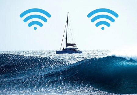
For anyone who has ever ventured beyond the shoreline, a common question arises: how far does mobile phone coverage extend from the coast? This inquiry delves into the intricate mechanisms of terrestrial cellular networks and their limitations, particularly as vessels navigate further into open waters. While land-based mobile reception typically diminishes around 15 nautical miles (approximately 28 kilometers) from the shore, this range is subject to various environmental, technological, and infrastructural factors. This article explores the nuances of mobile coverage at sea, the advent of sophisticated maritime communication systems, and the evolving landscape of connectivity for seafarers and passengers alike.
The Dynamics of Coastal Mobile Coverage: Terrestrial Networks and Their Reach
The initial phase of mobile connectivity for vessels departing port relies on the same cellular infrastructure that serves coastal communities. These terrestrial mobile phone antennas, strategically positioned along the coastline, emit radio signals omnidirectionally, allowing them to extend their reach over water. However, the effective range of these signals is not uniformly maintained and is influenced by a confluence of factors.

Primarily, the curvature of the Earth plays a fundamental role. Radio waves, especially those used for cellular communication (UHF/VHF bands), travel largely in a line-of-sight path. As a vessel moves further from the coast, the Earth’s curvature eventually obstructs the direct line of sight between the ship’s mobile device and the terrestrial antenna, leading to signal degradation and eventual loss. While the theoretical maximum line-of-sight can extend further depending on antenna height, practical cellular coverage is constrained.
Secondly, the power and orientation of coastal antennas are critical. Terrestrial cell towers are primarily designed and optimized to serve populations on land. Their power output and antenna beam patterns are typically configured to maximize coverage over populated areas, rather than extending far out to sea where the user density is significantly lower. Consequently, even if a signal could theoretically travel further, its strength rapidly diminishes to an unusable level due to this directional focus. Operators often reinforce coverage in tourist-heavy coastal zones during peak seasons, but this enhancement is still primarily land-focused.
Thirdly, environmental and geographical factors contribute to variability. Obstacles such as hills, large buildings, or even atmospheric conditions can interfere with signal propagation. While the open sea offers fewer physical obstructions compared to a dense urban environment, phenomena like atmospheric ducting can sometimes extend or reduce signal range unpredictably. Furthermore, network congestion can impact perceived coverage quality; a high concentration of users attempting to access the network simultaneously can lead to slower speeds and dropped connections, even within theoretical coverage zones.
Finally, the power limitations of mobile devices themselves are a significant constraint. Standard smartphones and tablets are designed with relatively low power transmitters (typically not exceeding 2 watts) to conserve battery life and comply with regulatory limits. This low power output limits their ability to effectively receive and transmit signals over long distances, particularly when the signal from the distant cell tower is already weak. Therefore, while terrestrial antennas might, in theory, project a signal tens of kilometers, a mobile device’s ability to "catch" and effectively utilize that signal diminishes much sooner, often reducing practical, reliable coverage to just a few kilometers offshore.
Beyond the Horizon: The Imperative of Satellite Connectivity
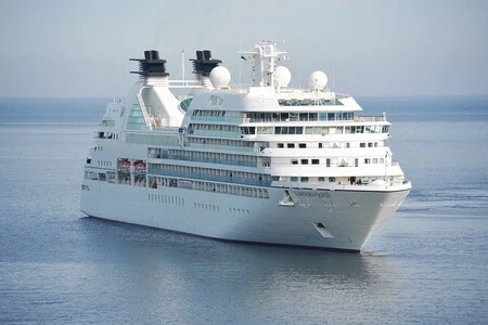
Once a vessel ventures beyond the practical reach of terrestrial cellular networks, typically beyond the aforementioned 15-28 kilometer threshold, conventional mobile phone service ceases. At this juncture, the provision of communication services shifts to more robust and far-reaching technologies, primarily satellite-based systems. For larger vessels such as cruise ships, ferries, and commercial cargo ships, maintaining connectivity is not merely a convenience but often a necessity for operational efficiency, safety, and passenger welfare.
The core technology enabling deep-sea connectivity is the Very Small Aperture Terminal (VSAT). These systems involve the installation of specialized satellite antennas and transceivers on board vessels. These "repeater antennas" establish a connection with geostationary satellites orbiting approximately 35,786 kilometers above the Earth’s equator. Geostationary satellites appear fixed in the sky from the perspective of an observer on Earth, allowing the ship’s VSAT antenna to maintain a continuous, stable connection.
Upon receiving the satellite signal, the VSAT system onboard converts it into a local cellular or Wi-Fi network that passengers and crew can connect to with their standard mobile devices. This creates a "bubble" of connectivity around the ship, mimicking a terrestrial network environment. However, this convenience comes at a significant cost. The bandwidth provided by traditional geostationary VSAT systems can be limited, and the sheer distance the signal must travel to and from the satellite introduces latency (delay) into the communication.

Historically, connecting to these maritime networks, often referred to as "maritime roaming," has been exorbitantly expensive. Telecommunication operators charge premium rates for voice calls, SMS messages, and particularly data usage, as these services are routed through satellite links managed by third-party providers. A single megabyte of data or a short phone call could incur charges equivalent to multiple hours of terrestrial usage, often leading to "bill shock" for unsuspecting travelers. This pricing structure reflected the high capital and operational costs associated with launching and maintaining satellites, managing ground stations, and providing dedicated bandwidth to vessels. Many passengers, therefore, opted to keep their phones in airplane mode to avoid inadvertent connections and prohibitive charges.
The Starlink Revolution: Transforming Maritime Internet
The landscape of maritime connectivity has, however, begun a dramatic transformation with the advent of Low Earth Orbit (LEO) satellite constellations, most notably Starlink, developed by SpaceX. Unlike geostationary satellites, LEO satellites orbit much closer to Earth, typically between 500 and 1,200 kilometers. This proximity offers several distinct advantages that are fundamentally reshaping deep-sea internet access:
- Reduced Latency: The shorter distance to LEO satellites significantly reduces signal travel time, resulting in much lower latency compared to geostationary systems. This translates to a more responsive internet experience, crucial for real-time applications like video conferencing, online gaming, and seamless web browsing.
- Higher Bandwidth and Speed: LEO constellations comprise thousands of interconnected satellites, forming a mesh network that can deliver substantially higher bandwidth and faster download/upload speeds than traditional VSAT systems. This enables multiple users onboard a ship to stream high-definition content, participate in video calls, and handle data-intensive tasks concurrently without significant degradation in performance.
- Global Coverage: With a large number of satellites continuously orbiting, LEO constellations aim to provide near-global coverage, including polar regions often underserved by geostationary satellites. This is particularly beneficial for vessels traversing remote sea lanes.
- Cost-Effectiveness: While initial deployment costs for LEO constellations are immense, the operational model and competitive market dynamics are driving down the cost of maritime internet services. For cruise lines and shipping companies, integrating Starlink means they can offer more affordable internet packages to passengers and crew, making connectivity an increasingly accessible amenity rather than a luxury.
The integration of Starlink into cruise ship fleets represents a significant shift. Cruise lines can now provide internet services that rival, and often surpass, the quality and speed of land-based connections. This enhances the passenger experience, allows crew members to stay in better contact with families, and supports more sophisticated onboard operations, including remote diagnostics and real-time data transfer for logistics and safety. Other satellite internet providers like Viasat, SES, and Eutelsat are also evolving their offerings, with some investing in their own LEO or MEO (Medium Earth Orbit) constellations or partnering with LEO providers to remain competitive in this rapidly expanding market. The "race to space" for connectivity is directly benefiting maritime users.
Essential Communication for Maritime Safety: Beyond Consumer Connectivity
While consumer mobile coverage and satellite internet address personal communication and entertainment, maritime safety and operational communication rely on dedicated, robust systems designed for reliability in challenging environments. These systems are regulated by international bodies such as the International Maritime Organization (IMO) and the International Telecommunication Union (ITU) to ensure global interoperability and effectiveness.
- Very High Frequency (VHF) Radio: This is the workhorse of short-range maritime communication. VHF radios operate on specific frequencies (e.g., marine channels 16 for distress and calling, 6, 8, 9 for ship-to-ship and ship-to-shore communication) and have a line-of-sight range of approximately 20-30 nautical miles (37-56 kilometers), depending on antenna height. They are crucial for communication with other vessels, port authorities, coast guard stations, and for receiving weather forecasts and navigational warnings. All commercial vessels and many recreational boats are mandated to carry VHF radios.
- Medium Frequency (MF) and High Frequency (HF) Radio: For communication over longer distances, MF and HF radios are utilized. MF typically covers hundreds of miles, while HF can achieve global reach by bouncing signals off the ionosphere. These systems are vital for vessels on long voyages, allowing them to communicate with shore stations or other ships far out at sea.
- Global Maritime Distress and Safety System (GMDSS): This international framework is a critical component of maritime safety, designed to automate and enhance emergency communication. GMDSS mandates specific equipment for vessels, including:
- EPIRBs (Emergency Position-Indicating Radio Beacons): Devices that transmit a distress signal and location via satellite to rescue coordination centers.
- SARTs (Search and Rescue Transponders): Used to help rescuers locate survival craft or distressed vessels.
- NAVTEX: An automated system for broadcasting maritime safety information (navigational warnings, weather forecasts, search and rescue information).
- Digital Selective Calling (DSC): An integral part of VHF, MF, and HF radios, allowing for automated distress alerts and targeted communication with specific stations or vessels.
GMDSS ensures that in the event of an emergency, a distress alert can be transmitted automatically and effectively, significantly improving response times.
- Satellite Phones: Beyond the internet-focused VSAT systems, dedicated satellite phones (e.g., Iridium, Inmarsat) offer voice and low-bandwidth data communication globally, even in the most remote ocean areas. These devices connect directly to constellations of satellites, providing a reliable lifeline for emergency calls or essential communications where other systems might fail. While their data speeds are generally lower than modern internet services, their robustness and ubiquitous coverage make them indispensable for critical communication.
These specialized communication systems underscore that while consumer mobile connectivity is increasingly available and affordable at sea, it does not replace the fundamental safety systems designed specifically for the maritime environment.
Navigating Costs and Connectivity: Practical Advice for Travelers
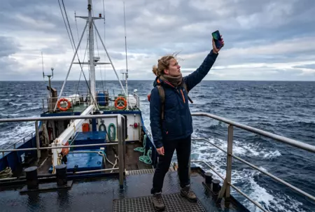
For passengers embarking on cruises or ferries, understanding the nuances of maritime connectivity is crucial to avoid unexpected charges.
- Coastal vs. Deep Sea: Remember that your standard mobile plan will work within a few kilometers of the coast. As you move further out, your phone will likely lose its connection to terrestrial networks.
- Airplane Mode is Your Friend: To prevent your phone from automatically connecting to expensive maritime roaming networks, activate airplane mode once you are a significant distance from shore. This disables all cellular and Wi-Fi radios, ensuring you don’t incur charges. You can then selectively enable Wi-Fi to connect to the ship’s network if you purchase a package.
- Understand Ship Wi-Fi Packages: Cruise lines now offer various Wi-Fi packages, often tiered by speed or data allowance. Research these options before your trip, as prices and performance can vary widely between operators and even within different packages on the same ship. With Starlink’s increasing adoption, many lines are now able to offer more competitive pricing and higher speeds.
- Check Roaming Rates: If you absolutely need cellular service at sea and plan to use the ship’s maritime roaming, contact your mobile operator before your voyage to inquire about their specific maritime roaming rates. Be prepared for these to be significantly higher than standard international roaming charges. Some operators may offer specific bundles or passes, but these are rare for deep-sea satellite connections.
- Utilize Onboard Resources: Many ships have internet cafes or designated Wi-Fi zones. Consider if you truly need constant connectivity or if occasional check-ins suffice.
Future Outlook: Towards a Seamlessly Connected Ocean
The future of maritime connectivity points towards greater integration, affordability, and reliability. The expansion of LEO satellite constellations like Starlink, alongside advancements from traditional satellite providers, promises to make high-speed internet a standard amenity across all types of vessels, not just luxury cruises. This will have profound implications:
- Enhanced Crew Welfare: Better connectivity allows seafarers to stay in touch with their families, improving morale and mental well-being, which is critical for an industry facing crew retention challenges.
- Operational Efficiency: Real-time data transfer will optimize logistics, enable predictive maintenance for ship systems, and improve navigation and weather routing, leading to fuel savings and safer operations.
- Environmental Monitoring: Improved connectivity can support more sophisticated environmental monitoring and data collection, aiding in oceanographic research and sustainable maritime practices.
- Autonomous Shipping: A highly connected ocean is a prerequisite for the development and widespread adoption of autonomous vessels, which will rely heavily on robust, low-latency communication for control and data exchange.
However, challenges remain. Regulatory frameworks must adapt to the proliferation of new satellite services, ensuring fair access and managing spectrum usage. Cybersecurity for maritime networks will become increasingly critical as vessels become more digitally integrated. Nevertheless, the trajectory is clear: the once isolated realm of the open sea is rapidly becoming a connected frontier, offering unprecedented opportunities for communication, commerce, and safety.
