
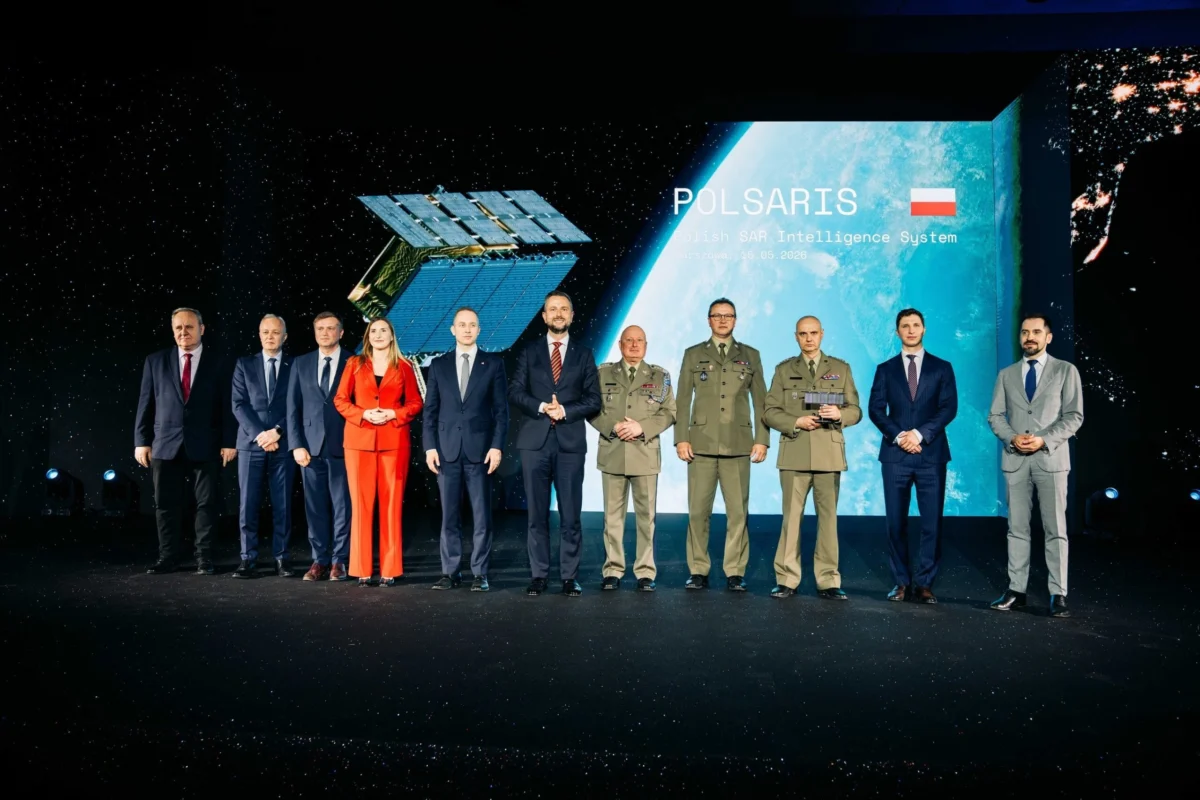
In a significant advancement for Eastern European defense infrastructure, the Finnish satellite manufacturer Iceye has officially transferred control of a dedicated radar satellite constellation to the Polish Armed Forces. This milestone marks the completion of the first phase of the Polish SAR Intelligence System, known as POLSARIS, a project designed to provide the nation with independent, high-resolution geospatial intelligence. The delivery was achieved in less than 12 months from the initial contract signing, an unprecedented timeframe for the deployment of sovereign space-based reconnaissance assets. The contract, valued at approximately 200 million euros, underscores Poland’s commitment to modernizing its military capabilities amidst a shifting regional security landscape.
The POLSARIS system is now under the operational command of ARGUS, the Polish Geospatial Intelligence and Satellite Services Agency. Established by the Ministry of National Defence in 2024, ARGUS serves as the central hub for processing and distributing satellite data to various branches of the Polish military and government. The rapid delivery of this capability included the successful launch of four Synthetic Aperture Radar (SAR) satellites, the establishment of a comprehensive ground segment, and the specialized training of Polish military operators who will now manage the constellation autonomously.
The Strategic Importance of Synthetic Aperture Radar
The core of the POLSARIS system lies in Synthetic Aperture Radar (SAR) technology. Unlike traditional optical satellites, which rely on sunlight and clear weather to capture images, SAR satellites emit microwave pulses that bounce off the Earth’s surface. By measuring the return signals, the system can create highly detailed maps of the terrain regardless of lighting or atmospheric conditions. This capability is of paramount importance for Poland, a nation that experiences significant cloud cover and long winter nights.
The ability to "see" through clouds, smoke, and darkness provides the Polish Armed Forces with a persistent monitoring capability. This is essential for tracking troop movements, monitoring border security, and assessing infrastructure changes in real-time. In the context of modern hybrid warfare and conventional conflict, the latency between a tactical requirement for imagery and the delivery of that data can be the difference between success and failure. By owning and operating its own SAR constellation, Poland eliminates the need to rely solely on third-party commercial providers or allied nations for high-priority intelligence, thereby achieving a higher degree of information autonomy.
Chronology of the POLSARIS Acquisition
The journey toward POLSARIS began in earnest following the escalation of regional tensions in 2022, which prompted the Polish Ministry of National Defence (MoD) to accelerate its "Observation Satellites" program. The objective was to move beyond the occasional purchase of commercial imagery toward a permanent, sovereign presence in low Earth orbit (LEO).
In the second half of 2023, following an intensive evaluation of global SAR providers, the Polish government entered into a strategic agreement with Iceye. The Finnish company was selected due to its proven track record in deploying "New Space" small satellites—compact, cost-effective units that offer performance comparable to traditional, much larger satellites.
Between the contract signing and the formal handover in late 2024, the project followed an aggressive timeline:
- Manufacturing and Integration: Iceye utilized its high-rate production facilities to customize four SAR satellites specifically for Polish requirements.
- Ground Segment Development: Simultaneously, the Polish Armaments Group (Polska Grupa Zbrojeniowa, or PGZ) worked to develop the domestic infrastructure required to communicate with the satellites. This included the construction of secure ground stations and the delivery of mobile mission control units.
- Launch Operations: The four satellites were launched into their designated orbits via dedicated and rideshare missions, ensuring a diverse orbital plane for optimized revisit rates over the Polish territory and areas of strategic interest.
- Operator Training: While the hardware was being prepared, a cohort of Polish military personnel underwent rigorous training in satellite flight dynamics, radar image interpretation, and system maintenance.
- Final Commissioning: In late 2024, the system underwent final acceptance testing, leading to the official announcement of operational readiness.
Integration with Domestic Industry and the Role of PGZ
A critical component of the POLSARIS project is the involvement of the Polish defense industry. The contract stipulated that the system must not only provide data but also foster domestic technological growth. A specialized segment of the Polish Armaments Group (PGZ) was tasked with delivering the ground segment and mobile infrastructure.
This domestic integration ensures that the Polish Armed Forces have complete end-to-end control over the data chain. The ground segment includes secure data processing centers capable of handling massive volumes of raw radar data and converting it into actionable intelligence. The mobile infrastructure is particularly noteworthy, as it allows the Polish military to deploy satellite downlinks closer to the front lines or in remote areas, enhancing the survivability and flexibility of the intelligence network.
The collaboration between Iceye and PGZ represents a hybrid model of international partnership, combining cutting-edge foreign satellite technology with local expertise in defense systems and secure communications. This approach ensures that the maintenance and future upgrades of the system can be managed, at least in part, by Polish engineers.
Official Responses and Political Context
The commissioning of POLSARIS has been met with significant acclaim from the highest levels of the Polish government. Deputy Prime Minister and Minister of National Defence Władysław Kosiniak-Kamysz emphasized the strategic shift this represents for the nation’s defense posture.

"We are investing in technologies that strengthen our security, information autonomy, and rapid response capabilities," Kosiniak-Kamysz stated during the delivery ceremony. "Thanks to satellite Earth observation systems, the Polish military is gaining a tool of strategic importance. This is not just a technological upgrade; it is a fundamental change in how we perceive and respond to threats on our borders and beyond."
The Ministry of National Defence characterized the delivery as a "milestone toward establishing modern intelligence-gathering capabilities." Military analysts suggest that the speed of the acquisition—completing a complex space program in under a year—is a signal to regional adversaries of Poland’s ability to rapidly integrate advanced technology.
From the perspective of Iceye, the delivery reinforces the company’s position as a primary partner for nations seeking sovereign orbital capabilities. While the company has not released specific internal statements regarding the Polish delivery beyond the factual report, its business model has increasingly shifted toward providing "Constellation-as-a-Service" or direct satellite sales to government entities, moving away from purely commercial data sales.
Analysis of Strategic Implications
The deployment of POLSARIS has several profound implications for Poland and the broader NATO Eastern Flank.
1. Enhanced Border Surveillance
Poland shares borders with Ukraine, Belarus, and the Russian exclave of Kaliningrad. The ability to monitor these regions 24/7, regardless of weather, provides a critical early warning system against unconventional threats, illegal crossings, or sudden military build-ups. SAR data is particularly effective at detecting changes in soil (indicating new trenches or vehicle tracks) and identifying metallic objects (tanks, artillery) hidden under camouflage netting.
2. Information Autonomy within NATO
While Poland remains a committed member of NATO and benefits from shared intelligence, the POLSARIS system allows Warsaw to contribute more robustly to the alliance’s common operating picture. Furthermore, it provides the Polish government with the "sovereign right of eye," allowing them to prioritize their own intelligence requirements without having to wait for bandwidth availability from allied assets.
3. Economic and Technological Spillover
The 200-million-euro investment acts as a catalyst for the Polish space sector. By establishing ARGUS and involving PGZ, the government is creating a professional class of space technicians and analysts. This expertise is expected to spill over into civil applications, such as disaster management, flood monitoring, and agricultural assessment, where SAR data is equally valuable.
4. Deterrence and Rapid Response
The "New Space" approach, characterized by small satellite constellations, offers a level of resilience that large, singular satellites do not. If one satellite in the POLSARIS constellation were to fail or be targeted, the remaining units continue to provide coverage. This resilience is a key factor in modern deterrence, as it complicates an adversary’s efforts to blind the nation’s intelligence apparatus.
Technical Specifications and Future Growth
While many technical details of the POLSARIS satellites remain classified, Iceye’s standard SAR platforms typically offer a spatial resolution of up to 25 centimeters in certain modes. The satellites operate in the X-band frequency, which provides a high level of detail for target identification.
The current four-satellite constellation is viewed as the "initial operational capability" (IOC). Plans are reportedly in discussion to expand the constellation to increase the frequency of revisits. A larger constellation would allow the Polish military to receive updated imagery of a specific location every few hours, rather than once or twice a day. This high-revisit capability is essential for tracking moving targets and dynamic battlefield conditions.
Furthermore, the integration of Artificial Intelligence (AI) and Machine Learning (ML) into the ARGUS processing pipeline is expected to be the next frontier. Automated change detection algorithms will be able to scan thousands of square kilometers of radar data to alert commanders to significant changes automatically, reducing the burden on human analysts.
Conclusion
The delivery of the POLSARIS system by Iceye to the Polish Armed Forces marks a definitive turning point in the regional security architecture of Central Europe. By securing a sovereign, weather-independent orbital surveillance capability in less than a year, Poland has demonstrated a new paradigm for military procurement and strategic readiness. As the ARGUS agency begins its operational life, the POLSARIS constellation will serve as a permanent sentinel in orbit, providing the information necessary to safeguard national sovereignty and contribute to the collective security of the European continent. The project stands as a testament to the power of public-private partnerships in the "New Space" era and sets a high bar for other nations looking to establish their own presence in the final frontier of national defense.
